Export
This application lets users export objects and data stored in geoh5 to various file formats.
The app currently supports:
ESRI Shapefile (shp)
Column file (csv)
Geotiff (1 or 3-band) (tiff)
UBC-GIF (Tensor or OcTree) (msh, mod)
New user? Visit the Getting Started page.
Application
The following sections provide details on the different parameters controlling the application. Interactive widgets shown below are for demonstration purposes only.
[1]:
from geoapps.export import Export

app = Export(h5file=r"../../../assets/FlinFlon.geoh5")
app()
Project Selection
Select and connect to an existing geoh5 project file containing data.
[2]:
app.project_panel
See the Project Panel page for more details.
Object and Data Selection
List of objects available for export from the target geoh5 project.
[3]:
app.data_panel
Output type
List of file formats currently supported.
[4]:
app.file_type
ESRI Shapefile
Export option to .shp file format for Points, Curve objects.
Projection
Coordinate system assigned to the shapefile, either as ESRI, EPSG or WKT code.
[5]:
app.projection_panel
Column Seperated Values
Export data to csv file format. The x, y and z coordinates of every nodes/cells are appended to the list of data by default.
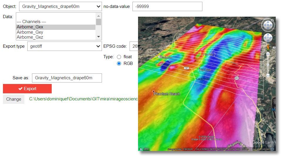
Geotiff
Export option to .geotiff for Grid2D objects.
Projection
Coordinate system assigned to the geotiff, either as ESRI, EPSG or WKT code.
[6]:
app.projection_panel
Type
Date type options exported to geotiff
[7]:
app.data_type
Float: Single-band image containing the float value of selected data.
RGB: 3-band image containing the RGB color displayed in Geoscience ANALYST.
UBC Model
Export option for BlockModel and Octree objects to UBC mesh (.msh) and model (.mod) format.
Output Panel
Trigger the computation routine and store the result.
[8]:
app.output_panel
See the Output Panel page for more details.
[ ]:
app.plot_result = True
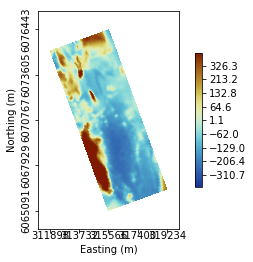
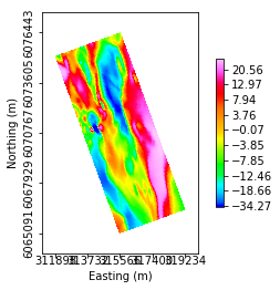
app.trigger.click()
Object saved to C:\Users\dominiquef\Documents\GIT\mira\geoapps\assets\Temp\Gravity_Magnetics_drape60m_Airborne_TMI.tif
Object saved to C:\Users\dominiquef\Documents\GIT\mira\geoapps\assets\Temp\Gravity_Magnetics_drape60m_Airborne_Gxx.tif
Need help? Contact us at support@mirageoscience.com